|
Tibet Tour April/May 2001 |
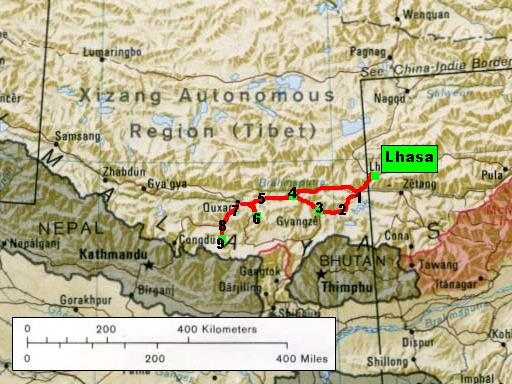
Section 4: From Lhasa to Mt. Everest
![]()
source: CIA
map of
the Chinese-Indian border , available from the University
of Texas at Austin
(link to detailed map)
![]()
The Friendship Highway, which connects Lhasa with Kathmandu in Nepal through the
Tibetan province Tsang, is the most interesting route in Tibet with major
attractions in Gyantse [3], Shigatse [4] and Sakya [6]. The road crosses several high
mountain passes: Kamba-la [1] (4794 m), Karo-la [2] (5045 m), Yulung-la [5]
(4950 m), Gyatso-la [7] (5220 m) and Pang-la [8] (5120 m).
![]()
![]()
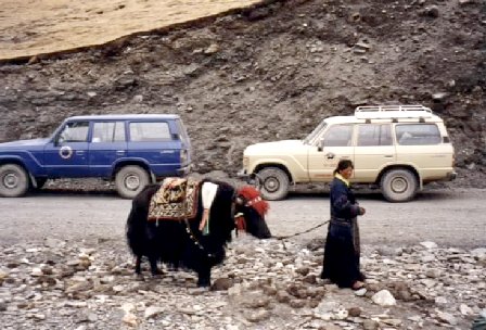
Traditional and modern transportation
A Tibetan woman is waiting on the Caro-la pass for customers to ride her Yak.
Behind are our two Toyota 4-wheel-drive Land Cruisers.
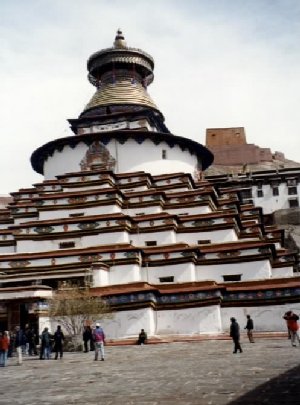 |
Gyantse Kumbum
|
![]()
![]()
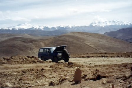
Car repair at 5000 m
The photo shows our Land Cruiser during a repair stop on the Pang-la
pass. In the background already the Himalaya peaks Makalu and Everest (left side) and
Cho Oyu (right side).